File:Siberia topo144.png
Size of this preview: 800 × 451 pixels. Other resolutions: 320 × 181 pixels | 640 × 361 pixels | 1,024 × 578 pixels | 1,280 × 722 pixels | 3,368 × 1,900 pixels.
Original file (3,368 × 1,900 pixels, file size: 2.32 MB, MIME type: image/png)
| Description |
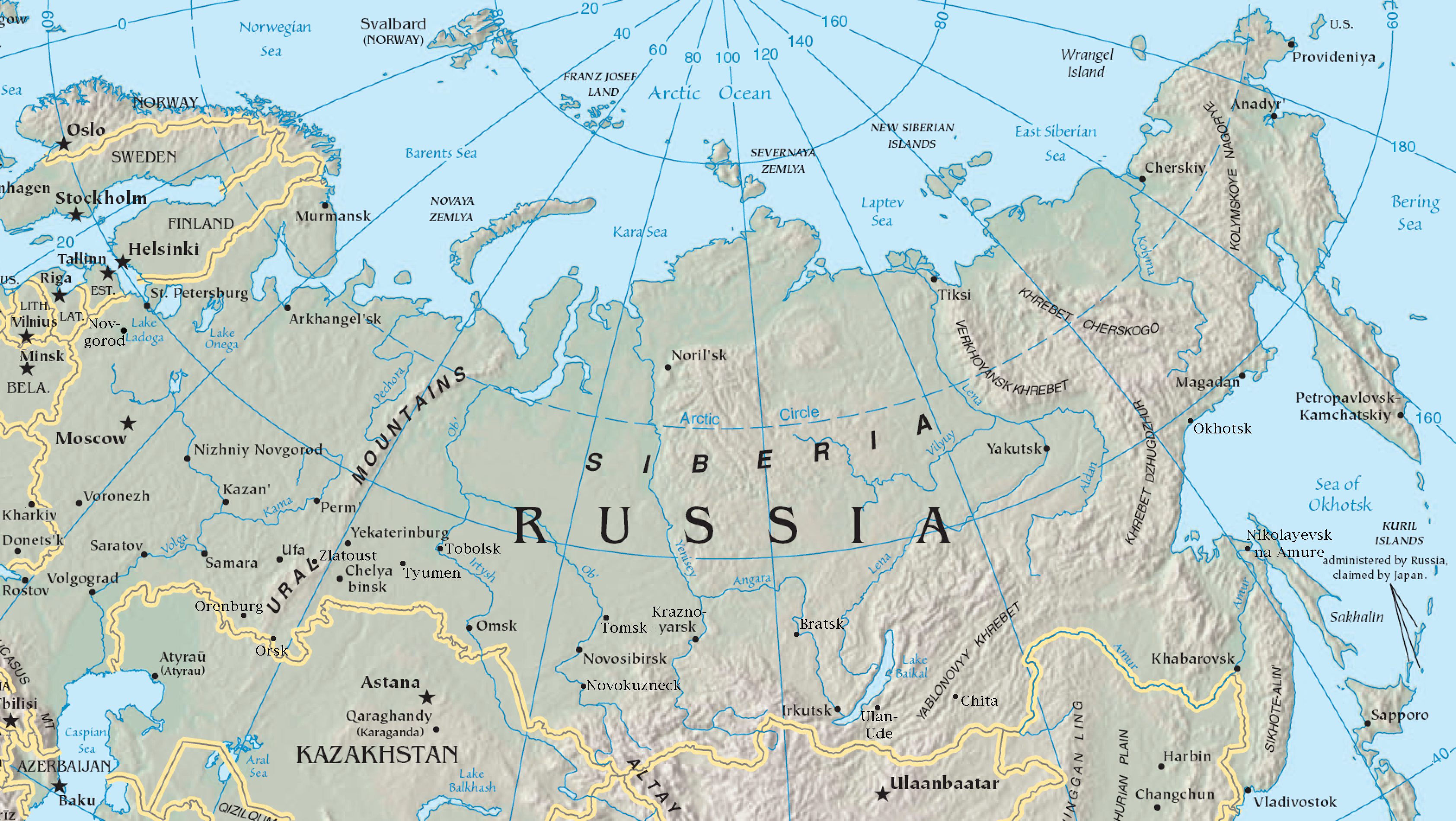
English: Map of northern Asia
Español: Mapa de Asia norte
Deutsch: Karte von Nordasien |
| Source | Via en:Image:Asia-map.png: cropped from https://www.cia.gov/cia/publications/factbook/reference_maps/pdf/asia.pdf, rendered at 250% magnification in Acrobat Reader —Veliath 18:21, 17 August 2006 (UTC) |
| Author | unknown, cut and additions by Ulamm 12:25, 18 April 2008 (UTC) |
| Other versions |
Derivative works of this file: Central siberian map.png Image:Asia.jpg, Image:Asia-map.png, Image:Sibirien Landschaften.png |
This image is in the public domain because it contains materials that originally came from the United States Central Intelligence Agency's World Factbook.
|
 |
File history
Click on a date/time to view the file as it appeared at that time.
| Date/Time | Thumbnail | Dimensions | User | Comment | |
|---|---|---|---|---|---|
| current | 13:28, 18 April 2008 | | 3,368 × 1,900 (2.32 MB) | Ulamm | |
| 13:04, 18 April 2008 |  | 3,368 × 1,900 (2.32 MB) | Ulamm | ||
| 12:51, 18 April 2008 |  | 3,368 × 1,900 (2.32 MB) | Ulamm | ||
| 12:25, 18 April 2008 |  | 3,368 × 1,900 (2.32 MB) | Ulamm | |Description= {{en|Map of northern Asia}} {{es|Mapa de Asia norte}} {{de|Karte von Nordasien}} |Source=Via en:Image:Asia-map.png: cropped from https://www.cia.gov/cia/publications/factbook/reference_maps/pdf/asia.pdf, rendered at 250% magnification i |
File usage
The following page uses this file:
Global file usage
The following other wikis use this file:
- Usage on af.wikipedia.org
- Usage on als.wikipedia.org
- Usage on de.wikipedia.org
- Usage on es.wikibooks.org
- Usage on fr.wikipedia.org
- Usage on oc.wikipedia.org