File:Miagao Map with Roads and Labels.png

Size of this preview: 551 × 599 pixels. Other resolutions: 221 × 240 pixels | 441 × 480 pixels | 706 × 768 pixels | 941 × 1,024 pixels | 2,000 × 2,176 pixels.
Original file (2,000 × 2,176 pixels, file size: 751 KB, MIME type: image/png)
Summary
| Description |
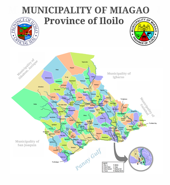
English: Map of the Municipality of Miagao showing barangay names and boundaries and roads. |
| Date | |
| Source | Own work |
| Author | Retdar |
Licensing
I, the copyright holder of this work, hereby publish it under the following license:
This file is licensed under the Creative Commons Attribution-Share Alike 4.0 International license.
- You are free:
- to share – to copy, distribute and transmit the work
- to remix – to adapt the work
- Under the following conditions:
- attribution – You must give appropriate credit, provide a link to the license, and indicate if changes were made. You may do so in any reasonable manner, but not in any way that suggests the licensor endorses you or your use.
- share alike – If you remix, transform, or build upon the material, you must distribute your contributions under the same or compatible license as the original.
File history
Click on a date/time to view the file as it appeared at that time.
| Date/Time | Thumbnail | Dimensions | User | Comment | |
|---|---|---|---|---|---|
| current | 12:52, 15 September 2023 | | 2,000 × 2,176 (751 KB) | Retdar | |
| 11:51, 14 December 2021 |  | 1,805 × 1,505 (236 KB) | Retdar | Updated town shape with the one used by the International Red Cross and the Mines and Geosciences Bureau | |
| 05:40, 24 September 2014 |  | 1,708 × 1,428 (240 KB) | Retdar | User created page with UploadWizard |
File usage
The following page uses this file:
Global file usage
The following other wikis use this file:
- Usage on en.wikipedia.org
- Usage on ja.wikipedia.org