آکسفورڈ (انگریزی: Oxford) برطانیہ کا ای رہائشی علاقہ جو انگلستان میں واقع ہے۔[2]
City of Oxford | ||
|---|---|---|
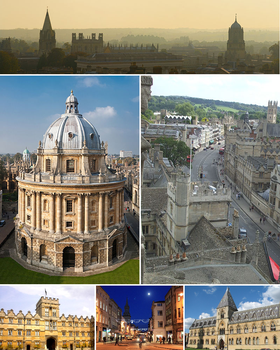
 From top left to bottom right: Oxford skyline panorama from St Mary's Church; Radcliffe Camera; High Street from above looking east; University College; High Street by night; Natural History Museum and Pitt Rivers Museum. | ||
| ||
| Nickname(s): | ||
| Motto(s): | ||
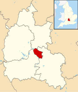
 Shown within آکسفورڈشائر | ||
| ملک |
| |
| آئین ساز ملک |
| |
| انگلستان کے علاقہ جات | جنوب مشرقی انگلستان | |
| Ceremonial county |
| |
| Admin HQ | Oxford City Centre | |
| قیام | 8th century | |
| City status | 1542 | |
| Government | ||
| • Type | City | |
| • Governing body | Oxford City Council | |
| • لارڈ میئر | Cllr Mohammed Abbasi (2014–2015) (Lab) | |
| • Sheriff of Oxford | Rae Humberstone (Lab) | |
| • Executive Council Leader |
Labour Cllr Bob Price | |
| • MPs |
Nicola Blackwood (کنزرویٹو پارٹی) Andrew Smith (L) | |
| Area | ||
| • City and غیر میٹروپولیٹن ضلع | 45.59 km2 (17.60 sq mi) | |
| Population (2011 تخمینہ) | ||
| • City and غیر میٹروپولیٹن ضلع | Template:Wp/khw/English district population ([[فہرست انگلستان کے اضلاع بلحاظ آبادی|ranked Template:Wp/khw/English district rank]] of Template:Wp/khw/English district total) | |
| • Density | 3,270/km2 (8,500/sq mi) | |
| • Urban | 171,380 | |
| • Metro | 244,000 | |
| • Ethnicity[1] |
72.4% White British 6.7% Other White 8.5% South Asian 3.7% Black 4.3% Chinese 3.0% Mixed Race 2.5% Other 1.4% White Irish | |
| Time zone | Wp/khw/UTC0 (گرینچ معیاری وقت) | |
| • Summer (DST) | Wp/khw/UTC+1 (BST) | |
| رمز ڈاک | ||
| آیزو 3166-2:GB | GB-OXF | |
| ONS code |
38UC (ONS) E07000178 (GSS) | |
| OS grid reference | Template:Wp/khw/gbmappingsmall | |
| Website | www.oxford.gov.uk | |
تفصیلات
editآکسفورڈو رقبہ 45.59 مربع کیلومیٹر شیر.
مزید
editحوالہ جات
edit- ↑ "Resident Population Estimates by Ethnic Group (Percentages)". National Statistics. Archived from the original on 25 December 2018.
- ↑ Template:Wp/khw/Wp/khw/cite web
