File:Tamazgha map.png
Size of this preview: 600 × 600 pixels. Other resolutions: 240 × 240 pixels | 480 × 480 pixels | 768 × 768 pixels | 1,024 × 1,024 pixels | 2,048 × 2,048 pixels.
Original file (2,048 × 2,048 pixels, file size: 493 KB, MIME type: image/png)

|
This map image could be re-created using vector graphics as an SVG file. This has several advantages; see Commons:Media for cleanup for more information. If an SVG form of this image is available, please upload it and afterwards replace this template with
{{vector version available|new image name}}.
It is recommended to name the SVG file “Tamazgha map.svg”—then the template Vector version available (or Vva) does not need the new image name parameter. |
Summary
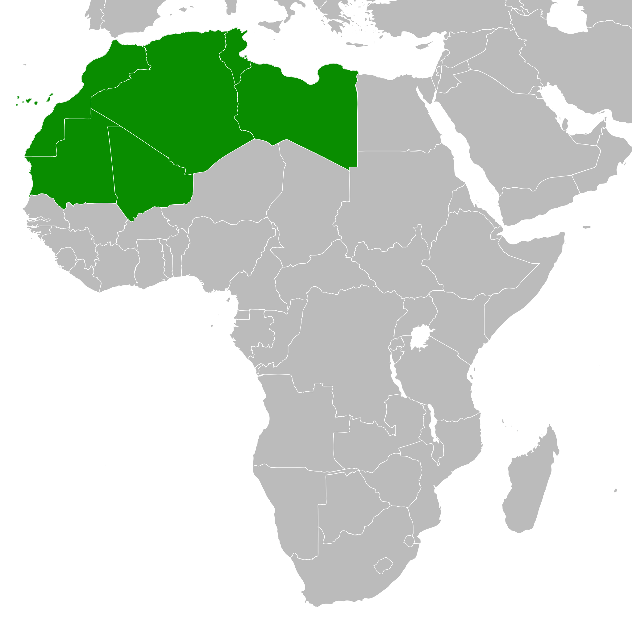
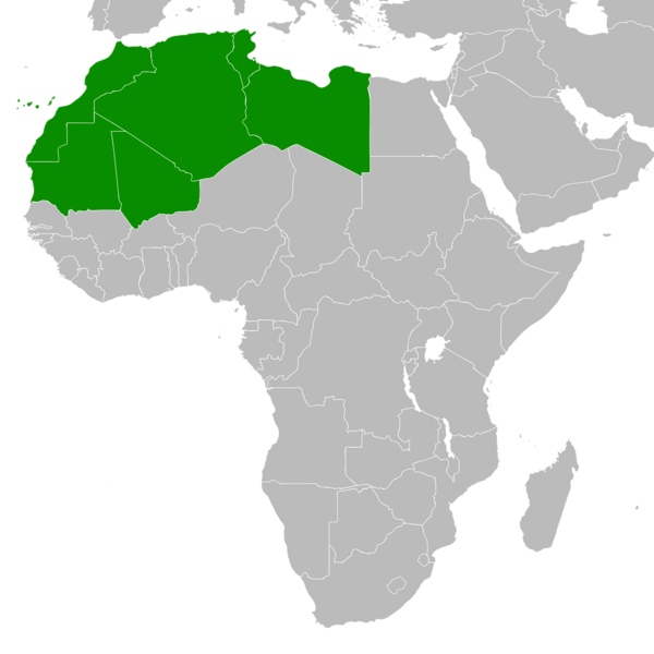
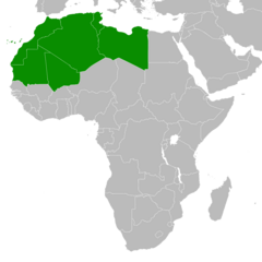
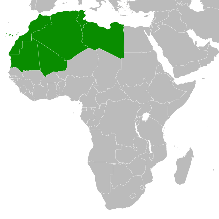
| Description | The Amazigh Tamazgha area — of North and West Africa. |
| Date | |
| Source | Own work (Original text: self-made, already in it.wiki) |
| Author | Vermondo |
Licensing
Vermondo, the copyright holder of this work, hereby publishes it under the following licenses:

|
Permission is granted to copy, distribute and/or modify this document under the terms of the GNU Free Documentation License, Version 1.2 or any later version published by the Free Software Foundation; with no Invariant Sections, no Front-Cover Texts, and no Back-Cover Texts. A copy of the license is included in the section entitled GNU Free Documentation License. |
| This file is licensed under the Creative Commons Attribution-Share Alike 3.0 Unported license. | ||
| Attribution: Vermondo | ||
| ||
| This licensing tag was added to this file as part of the GFDL licensing update. |
This file is licensed under the Creative Commons Attribution-Share Alike 2.5 Generic, 2.0 Generic and 1.0 Generic license.
Attribution: Vermondo
- You are free:
- to share – to copy, distribute and transmit the work
- to remix – to adapt the work
- Under the following conditions:
- attribution – You must give appropriate credit, provide a link to the license, and indicate if changes were made. You may do so in any reasonable manner, but not in any way that suggests the licensor endorses you or your use.
- share alike – If you remix, transform, or build upon the material, you must distribute your contributions under the same or compatible license as the original.
You may select the license of your choice.
File history
Click on a date/time to view the file as it appeared at that time.
| Date/Time | Thumbnail | Dimensions | User | Comment | |
|---|---|---|---|---|---|
| current | 15:20, 17 September 2023 | | 2,048 × 2,048 (493 KB) | ⵣⵉⵔⵉ ⴰⵎⵖⵏⴰⵙ | Add new version |
| 15:30, 17 March 2018 |  | 360 × 392 (10 KB) | Maphobbyist | Montenegro border | |
| 18:44, 9 July 2011 |  | 360 × 392 (13 KB) | Maphobbyist | South Sudan has become independent on July 9, 2011. Sudan and South Sudan are shown with the new international border between them. | |
| 13:53, 7 May 2007 |  | 360 × 392 (14 KB) | Vermondo | {{Information |Description=The Tamazgha area (Northern Africa |Source=self-made, already in it.wiki |Date=March 2006 |Author= User:Vermondo }} |
File usage
The following 7 pages use this file:
Global file usage
The following other wikis use this file: