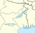
File:Santali map.png

Size of this preview: 516 × 599 pixels. Other resolutions: 207 × 240 pixels | 413 × 480 pixels | 661 × 768 pixels | 882 × 1,024 pixels | 1,510 × 1,753 pixels.
Original file (1,510 × 1,753 pixels, file size: 303 KB, MIME type: image/png)
File history
Click on a date/time to view the file as it appeared at that time.
| Date/Time | Thumbnail | Dimensions | User | Comment | |
|---|---|---|---|---|---|
| current | 03:09, 14 July 2022 |  | 1,510 × 1,753 (303 KB) | Dev0745 | Reverted to version as of 17:14, 5 March 2020 (UTC) as per census 2011 |
| 19:33, 25 June 2020 |  | 428 × 406 (61 KB) | C1MM | Reverted to version as of 19:27, 25 June 2020 (UTC) | |
| 19:29, 25 June 2020 |  | 428 × 406 (61 KB) | C1MM | Reverted to version as of 19:24, 25 June 2020 (UTC) | |
| 19:27, 25 June 2020 |  | 428 × 406 (61 KB) | C1MM | Fixed boundaries | |
| 19:24, 25 June 2020 |  | 428 × 406 (61 KB) | C1MM | Fixed boundaries | |
| 19:14, 25 June 2020 |  | 428 × 405 (60 KB) | C1MM | Reduced area | |
| 17:14, 5 March 2020 |  | 1,510 × 1,753 (303 KB) | C1MM | Uploaded a work by Own work based off of Nichalp from Derivative of India-locator-map-blank.svg with UploadWizard |
File usage
The following page uses this file:
Global file usage
The following other wikis use this file:
- Usage on ast.wikipedia.org
- Usage on az.wikipedia.org
- Usage on be.wikipedia.org
- Usage on ca.wikipedia.org
- Usage on diq.wikipedia.org
- Usage on eo.wikipedia.org
- Usage on lv.wikipedia.org
- Usage on oc.wikipedia.org
- Usage on ru.wikipedia.org
- Usage on sat.wikipedia.org
- Usage on vi.wikipedia.org
- Usage on www.wikidata.org