File:Political map of India HI.svg

Size of this PNG preview of this SVG file: 511 × 599 pixels. Other resolutions: 205 × 240 pixels | 410 × 480 pixels | 655 × 768 pixels | 874 × 1,024 pixels | 1,748 × 2,048 pixels | 1,594 × 1,868 pixels.
Original file (SVG file, nominally 1,594 × 1,868 pixels, file size: 301 KB)
Summary
| Description |
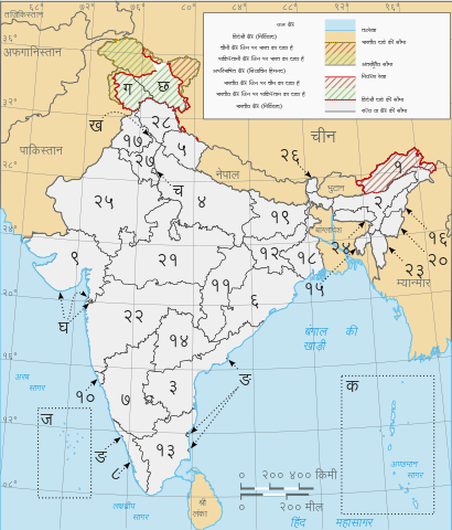
हिन्दी: भारत का मानचित्र। |
| Date | |
| Source | File:Political map of India EN.svg |
| Author | Saravask |
| Other versions |
|


Licensing
This file is licensed under the Creative Commons Attribution-Share Alike 3.0 Unported license.
- You are free:
- to share – to copy, distribute and transmit the work
- to remix – to adapt the work
- Under the following conditions:
- attribution – You must give appropriate credit, provide a link to the license, and indicate if changes were made. You may do so in any reasonable manner, but not in any way that suggests the licensor endorses you or your use.
- share alike – If you remix, transform, or build upon the material, you must distribute your contributions under the same or compatible license as the original.
File history
Click on a date/time to view the file as it appeared at that time.
| Date/Time | Thumbnail | Dimensions | User | Comment | |
|---|---|---|---|---|---|
| current | 11:52, 7 August 2020 | | 1,594 × 1,868 (301 KB) | अतुलयादव | Added new Union Territories. नए केंद्र शासित प्रदेशों का समावेश किया हैं। ~~~~ |
| 11:40, 4 January 2020 |  | 1,594 × 1,868 (306 KB) | 1997kB | Reverted to version as of 18:05, 4 November 2014 (UTC) oops something not worked well | |
| 11:27, 4 January 2020 |  | 512 × 600 (349 KB) | 1997kB | updated map | |
| 18:05, 4 November 2014 |  | 1,594 × 1,868 (306 KB) | संजीव कुमार | updated image, चित्र को अद्यतन किया। | |
| 18:04, 4 November 2014 |  | 1,594 × 1,868 (306 KB) | संजीव कुमार | updated new state नया राज्य अद्यतन किया। | |
| 15:31, 22 March 2014 |  | 1,594 × 1,868 (309 KB) | Wikiuser13 | User created page with UploadWizard |
File usage
The following page uses this file:
Global file usage
The following other wikis use this file:
- Usage on hi.wikipedia.org
- Usage on sa.wikipedia.org