File:Paris europe train map.png
Size of this preview: 552 × 600 pixels. Other resolutions: 221 × 240 pixels | 442 × 480 pixels | 707 × 768 pixels | 1,024 × 1,113 pixels.
Original file (1,024 × 1,113 pixels, file size: 62 KB, MIME type: image/png)
| Description |
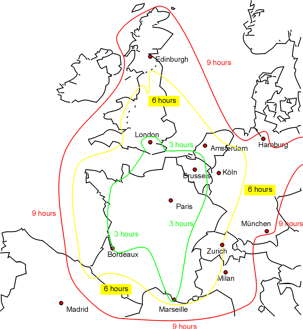
English: Sketch map showing approximate journey times on the train from Paris to the rest of western Europe. Drawn by Bob Tubbs, based on queries to the SNCF website. |
||
| Date | 31 May 2005 (original upload date) | ||
| Source | Own work | ||
| Author | User:Rnt20 | ||
| Permission (Reusing this file) |
|
||
| Other versions |
Derivative works of this file: |

|
This transport map image could be re-created using vector graphics as an SVG file. This has several advantages; see Commons:Media for cleanup for more information. If an SVG form of this image is available, please upload it and afterwards replace this template with
{{vector version available|new image name}}.
It is recommended to name the SVG file “Paris europe train map.svg”—then the template Vector version available (or Vva) does not need the new image name parameter. |
File history
Click on a date/time to view the file as it appeared at that time.
| Date/Time | Thumbnail | Dimensions | User | Comment | |
|---|---|---|---|---|---|
| current | 19:36, 31 May 2005 | | 1,024 × 1,113 (62 KB) | Rnt20 | Sketch map showing approximate journey times on the train from Paris to the rest of western Europe. Drawn by Bob Tubbs, based on queries to the SNCF website. A French version can be seen at Image:paris_europe_train_map_fr.png {{PD-self}} |
File usage
The following page uses this file:
Global file usage
The following other wikis use this file:
- Usage on cs.wikipedia.org
- Usage on en.wikipedia.org
- Usage on en.wikinews.org
- Usage on en.wikivoyage.org
- Usage on fa.wikivoyage.org
- Usage on he.wikivoyage.org
- Usage on zh.wikipedia.org
- Usage on zh.wikivoyage.org