File:Northern Ireland - Counties.png

Size of this preview: 705 × 599 pixels. Other resolutions: 282 × 240 pixels | 565 × 480 pixels | 903 × 768 pixels | 1,204 × 1,024 pixels | 1,677 × 1,426 pixels.
Original file (1,677 × 1,426 pixels, file size: 229 KB, MIME type: image/png)
| Description |
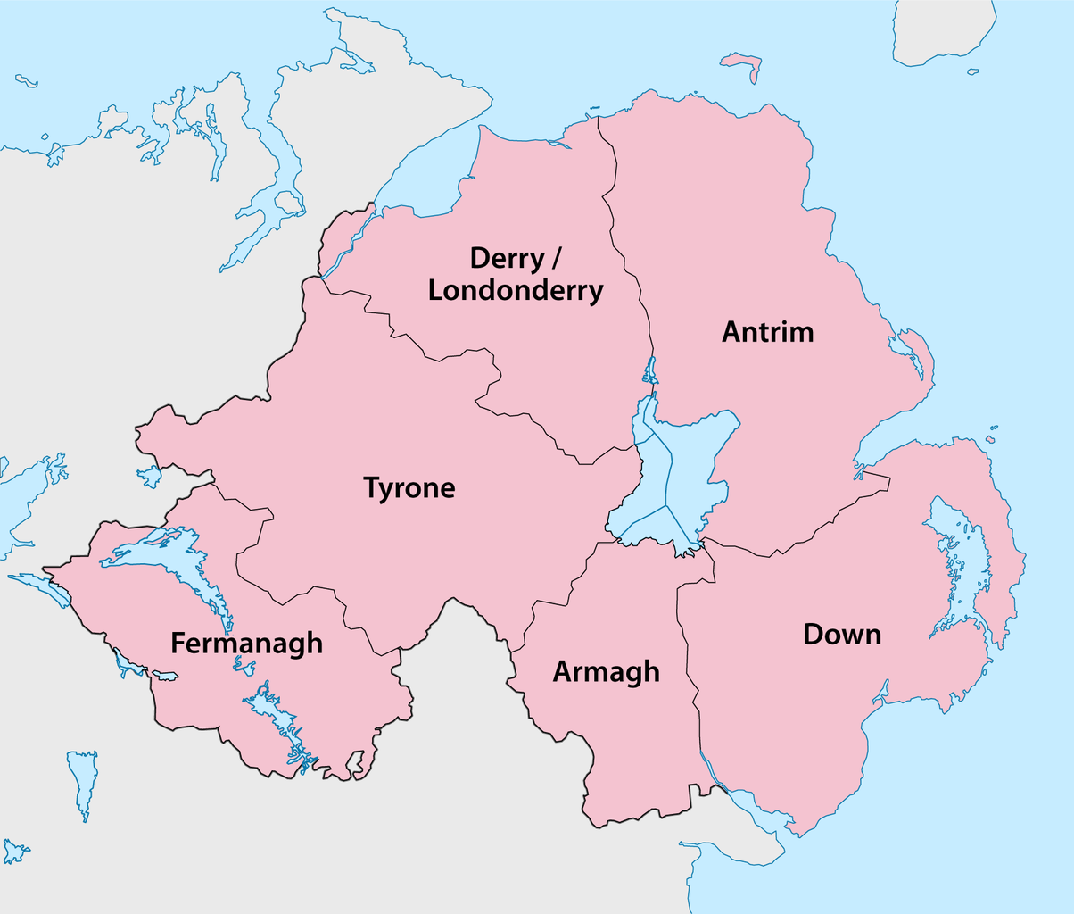
Deutsch: Counties von Nordirland
English: Counties of Northern Ireland |
||
| Date | |||
| Source | Self made, using Northern Ireland - Counties copy|this map by NNW | ||
| Author | Maximilian Dörrbecker (Chumwa) | ||
| Permission (Reusing this file) |
I, the copyright holder of this work, hereby publish it under the following license: This file is licensed under the Creative Commons Attribution-Share Alike 2.5 Generic license.
Sie dürfen das Bild zu den folgenden Bedingungen nutzen:
|
||
| Other versions |
|


File history
Click on a date/time to view the file as it appeared at that time.
| Date/Time | Thumbnail | Dimensions | User | Comment | |
|---|---|---|---|---|---|
| current | 18:49, 28 September 2009 | | 1,677 × 1,426 (229 KB) | Chumwa | {{Information |Description= {{ de }} Counties von Nordirland {{ en }} Counties of Northern Ireland |Source=Self made, using this map by NNW |Date=2009-09 |Author= [[:de:User:Chumwa|Maximili |
File usage
The following page uses this file:
Global file usage
The following other wikis use this file:
- Usage on af.wikipedia.org
- Usage on blk.wikipedia.org
- Usage on bn.wikipedia.org
- Usage on bxr.wikipedia.org
- Usage on cs.wikipedia.org
- Usage on de.wikipedia.org
- Usage on el.wikipedia.org
- Usage on en.wikipedia.org
- Usage on eo.wikipedia.org
- Usage on fa.wikipedia.org
- Usage on fi.wikipedia.org
- Usage on fr.wikipedia.org
- Usage on ga.wikipedia.org
- Usage on gl.wikipedia.org
- Usage on id.wikipedia.org
- Usage on it.wikipedia.org
- Usage on ja.wikipedia.org
- Usage on ko.wikipedia.org
- Usage on mni.wikipedia.org
- Usage on my.wikipedia.org
- Usage on mzn.wikipedia.org
- Usage on no.wikipedia.org
- Usage on pcd.wikipedia.org
- Usage on pl.wikipedia.org
- Usage on ps.wikipedia.org
- Usage on ru.wikipedia.org
- Usage on sco.wikipedia.org
- Usage on sq.wikipedia.org
- Usage on ur.wikipedia.org
- Usage on zh.wikipedia.org