File:Mapa części Niziny Śląsko Łużyckiej i Wału Trzebnickiego.png

Size of this preview: 800 × 482 pixels. Other resolutions: 320 × 193 pixels | 640 × 385 pixels | 1,024 × 616 pixels | 1,280 × 770 pixels | 2,560 × 1,541 pixels | 3,665 × 2,206 pixels.
Original file (3,665 × 2,206 pixels, file size: 1.69 MB, MIME type: image/png)
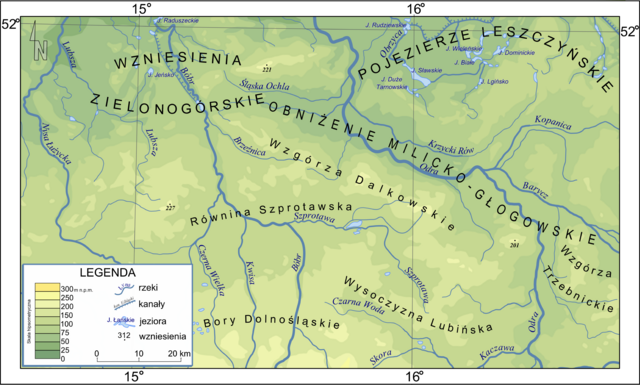
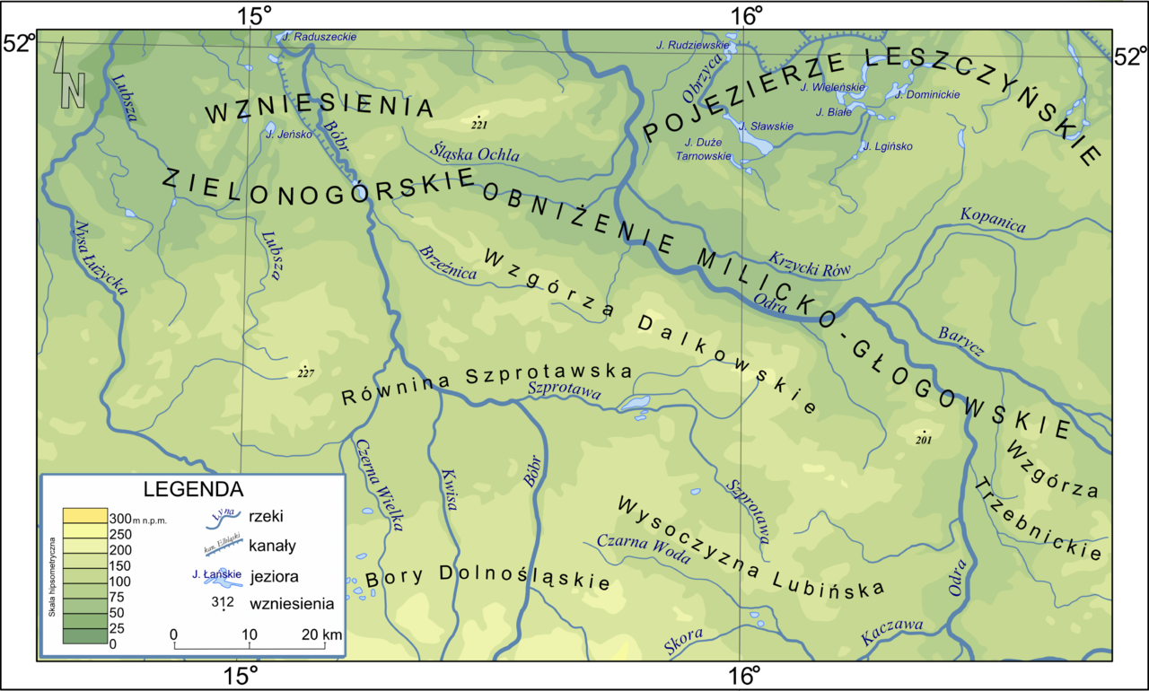
| Description | Mapa części Niziny Śląsko Łużyckiej i Wału Trzebnickiego |
| Date | |
| Source | Own work |
| Author | Marcin n® ☼ |
| Permission (Reusing this file) |
This file is licensed under the Creative Commons Attribution-Share Alike 2.5 Generic license.
|
File history
Click on a date/time to view the file as it appeared at that time.
| Date/Time | Thumbnail | Dimensions | User | Comment | |
|---|---|---|---|---|---|
| current | 20:49, 27 September 2010 | | 3,665 × 2,206 (1.69 MB) | Masur | typos |
| 21:31, 26 December 2006 |  | 3,550 × 2,137 (1.46 MB) | MARCIN N | {{Information |Description=Mapa części Niziny Śląsko Łużyckiej i Wału Trzebnickiego |Source=own work |Date=2006 |Author={{Marcin n}} |Permission={{cc-by-sa-2.5}} }} |
File usage
The following page uses this file:
Global file usage
The following other wikis use this file:
- Usage on ceb.wikipedia.org
- Usage on cs.wikipedia.org
- Usage on da.wikipedia.org
- Usage on de.wikipedia.org
- Usage on el.wikipedia.org
- Usage on en.wikipedia.org
- Usage on eo.wikipedia.org
- Usage on es.wikipedia.org
- Usage on fr.wikipedia.org
- Usage on it.wikipedia.org
- Usage on lld.wikipedia.org
- Usage on nds.wikipedia.org
- Usage on nn.wikipedia.org
- Usage on pl.wikipedia.org
- Śląsk
- Wzniesienia Żarskie
- Pojezierze Leszczyńskie
- Czerna Wielka
- Szprotawa (rzeka)
- Węgliniec
- Obniżenie Milicko-Głogowskie
- Śląska Ochla
- Bory Dolnośląskie
- Czarna Woda (dopływ Kaczawy)
- Krzycki Rów
- Wzniesienia Zielonogórskie
- Wzgórza Dalkowskie
- Wikipedysta:Marcin n/grafiki
- Równina Legnicka
- Wysoczyzna Lubińska
- Równina Szprotawska
- Usage on ru.wikipedia.org
- Usage on sv.wikipedia.org
- Usage on uk.wikipedia.org
- Usage on www.wikidata.org
View more global usage of this file.