File:Map of Pennsylvania NA.png
Size of this preview: 776 × 600 pixels. Other resolutions: 311 × 240 pixels | 621 × 480 pixels | 994 × 768 pixels | 1,280 × 989 pixels | 2,122 × 1,640 pixels.
Original file (2,122 × 1,640 pixels, file size: 2.56 MB, MIME type: image/png)
Summary
| Description |
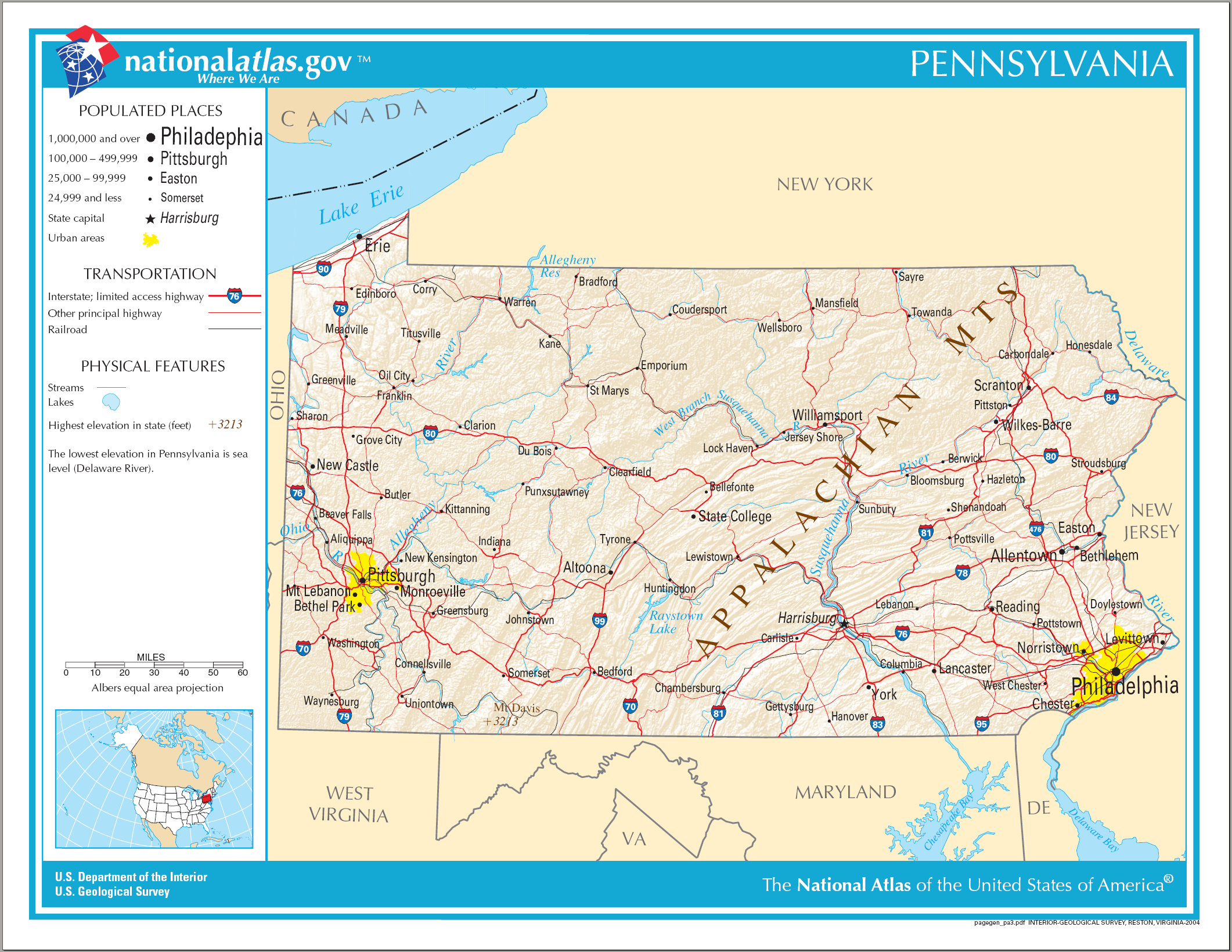
English: Map of Pennsylvania. |
| Date | |
| Source | National Atlas |
| Author |
Licensing
This map was obtained from an edition of the National Atlas of the United States. Like almost all works of the U.S. federal government, works from the National Atlas are in the public domain in the United States.
Online access: NationalAtlas.gov | 1970 print edition: Library of Congress, Perry-Castañeda Library
|
File history
Click on a date/time to view the file as it appeared at that time.
| Date/Time | Thumbnail | Dimensions | User | Comment | |
|---|---|---|---|---|---|
| current | 09:40, 15 August 2006 | | 2,122 × 1,640 (2.56 MB) | Huebi~commonswiki | {{Information| |Description=Map of Pennsylvania |Source=[http://www.nationalatlas.gov National Atlas] }} Category:Maps of the United States Category:Maps of Pennsylvania {{PD-USGov-Atlas}} |
File usage
The following page uses this file:
Global file usage
The following other wikis use this file:
- Usage on als.wikipedia.org
- Usage on ar.wikipedia.org
- Usage on bn.wikipedia.org
- Usage on bs.wikipedia.org
- Usage on ca.wikipedia.org
- Usage on de.wikipedia.org
- Usage on en.wikipedia.org
- Usage on fi.wikipedia.org
- Usage on fr.wikipedia.org
- Usage on hi.wikipedia.org
- Usage on hr.wiktionary.org
- Usage on hsb.wikipedia.org
- Usage on hu.wikipedia.org
- Usage on ilo.wikipedia.org
- Usage on it.wikipedia.org
- Usage on lt.wikipedia.org
- Usage on ru.wikivoyage.org
- Usage on simple.wikipedia.org
- Usage on si.wikipedia.org
- Usage on sw.wikipedia.org
- Usage on szl.wikipedia.org
- Usage on zea.wikipedia.org