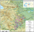
File:Karabakh war 2020 de.png

Size of this preview: 623 × 600 pixels. Other resolutions: 249 × 240 pixels | 499 × 480 pixels | 798 × 768 pixels | 1,064 × 1,024 pixels | 2,128 × 2,048 pixels | 2,821 × 2,715 pixels.
Original file (2,821 × 2,715 pixels, file size: 8.34 MB, MIME type: image/png)
File history
Click on a date/time to view the file as it appeared at that time.
| Date/Time | Thumbnail | Dimensions | User | Comment | |
|---|---|---|---|---|---|
| current | 19:21, 10 July 2021 |  | 2,821 × 2,715 (8.34 MB) | Don-kun | change caption |
| 17:14, 13 June 2021 |  | 2,821 × 2,715 (8.39 MB) | Don-kun | small corrections | |
| 19:19, 8 June 2021 |  | 2,821 × 2,715 (8.39 MB) | Don-kun | small corrections | |
| 20:31, 29 May 2021 |  | 2,821 × 2,715 (8.39 MB) | Don-kun | {{Information |Description={{de|1= Krieg um Bergkarabach 2020, Karte mit Übersicht der Offensiven auf topografischem Hintergrund.</br> Beschriftung mit deutschen Toponymen, für Übersichtlichkeit und Lesbarkeit bewusst nur die de-jure-Namen gewählt, ausgewählt aus sowie in einigen Fällen in analoger Schreibweise gebildet, vgl File:Topo map Arzach de.png }} |Source={{own}}; Topographischer Hintergrund: [http://www2.jpl.nasa.gov/srtm NASA Shuttle Radar Topography Mission] (public domain). S... |
File usage
The following page uses this file:
Global file usage
The following other wikis use this file:
- Usage on de.wikipedia.org
- Usage on www.wikidata.org
