File:Great-zim-aerial-looking-West.JPG
Size of this preview: 800 × 532 pixels. Other resolutions: 320 × 213 pixels | 640 × 425 pixels | 1,024 × 680 pixels | 1,280 × 850 pixels | 2,560 × 1,701 pixels | 4,672 × 3,104 pixels.
Original file (4,672 × 3,104 pixels, file size: 4.33 MB, MIME type: image/jpeg)
Summary
| Description |
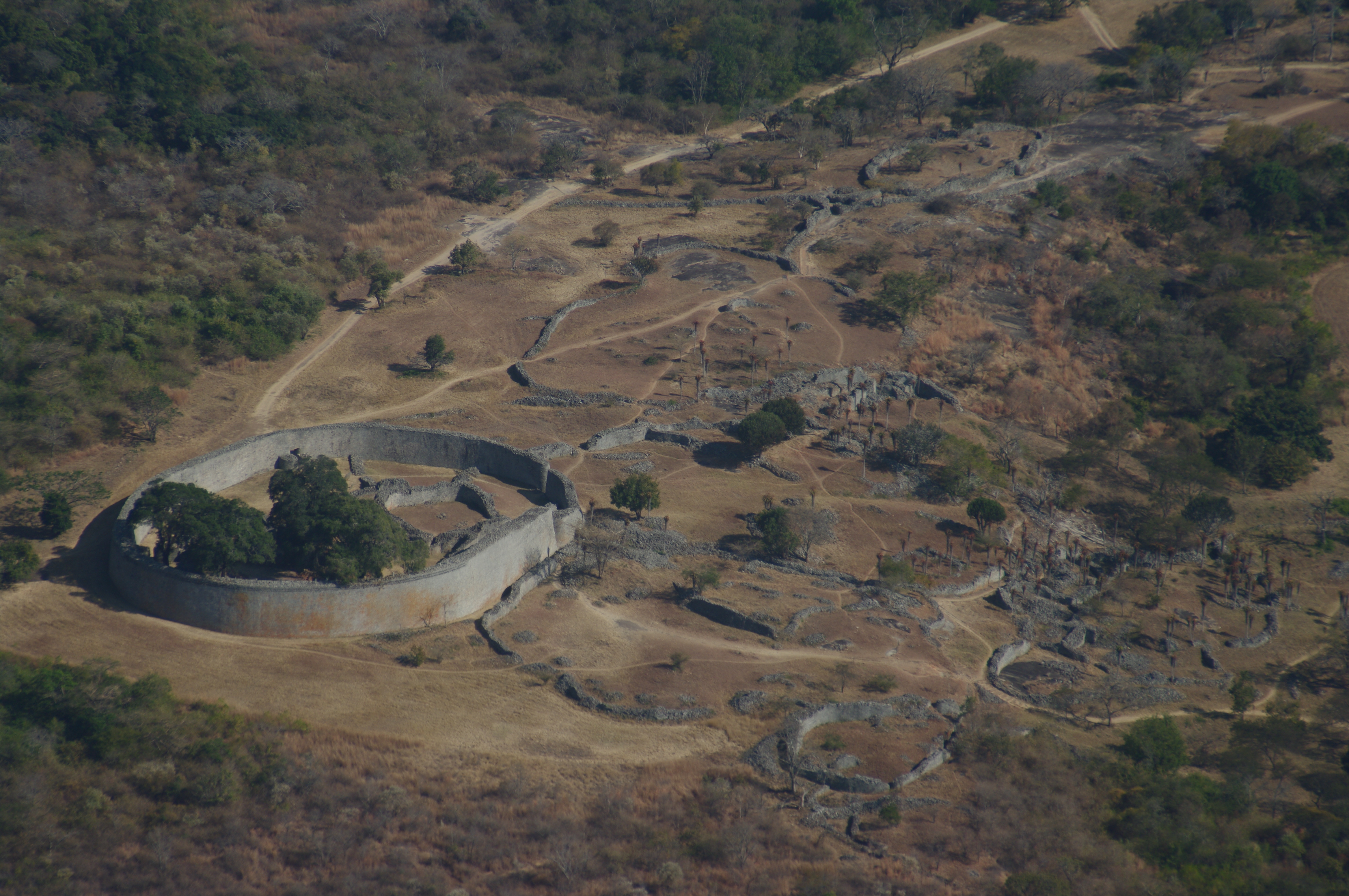
English: Aerial view of Great Zimbabwe's Great Enclosure (circumference 250 m, maximum height 11 m)[1] and adjacent ruins looking southeast from the Hill Fort. |
| Date | |
| Source | Own work |
| Author | Janice Bell |
| Camera location | | View this and other nearby images on: OpenStreetMap |
|---|
|
This place is a UNESCO World Heritage Site, listed as
Great Zimbabwe National Monument.
|
Geocoding added by Martinvl after comparing this image with Google Earth.
References
- ↑ Great Zimbabwe Presentation 13. British Museum. Retrieved on 23 February 2016.
Licensing
I, the copyright holder of this work, hereby publish it under the following license:
This file is licensed under the Creative Commons Attribution-Share Alike 4.0 International license.
- You are free:
- to share – to copy, distribute and transmit the work
- to remix – to adapt the work
- Under the following conditions:
- attribution – You must give appropriate credit, provide a link to the license, and indicate if changes were made. You may do so in any reasonable manner, but not in any way that suggests the licensor endorses you or your use.
- share alike – If you remix, transform, or build upon the material, you must distribute your contributions under the same or compatible license as the original.
This file is licensed under the Creative Commons Attribution-Share Alike 3.0 Unported license.
- You are free:
- to share – to copy, distribute and transmit the work
- to remix – to adapt the work
- Under the following conditions:
- attribution – You must give appropriate credit, provide a link to the license, and indicate if changes were made. You may do so in any reasonable manner, but not in any way that suggests the licensor endorses you or your use.
- share alike – If you remix, transform, or build upon the material, you must distribute your contributions under the same or compatible license as the original.

|
This image has been assessed under the valued image criteria and is considered the most valued image on Commons within the scope: Aerial view of Great Zimbabwe. You can see its nomination here. |
File history
Click on a date/time to view the file as it appeared at that time.
| Date/Time | Thumbnail | Dimensions | User | Comment | |
|---|---|---|---|---|---|
| current | 21:23, 1 September 2015 | | 4,672 × 3,104 (4.33 MB) | Jncbll | User created page with UploadWizard |
File usage
There are no pages that use this file.
Global file usage
The following other wikis use this file:
- Usage on af.wikipedia.org
- Usage on avk.wikipedia.org
- Usage on az.wikipedia.org
- Usage on ba.wikipedia.org
- Usage on de.wikipedia.org
- Usage on el.wikipedia.org
- Usage on en.wikipedia.org
- Usage on es.wikipedia.org
- Usage on fi.wikipedia.org
- Usage on fr.wikipedia.org
- Usage on id.wikipedia.org
- Usage on lt.wiktionary.org
- Usage on sr.wikipedia.org
- Usage on uk.wikipedia.org