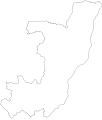
File:Flag map of the Republic of the Congo.svg

Size of this PNG preview of this SVG file: 512 × 595 pixels. Other resolutions: 206 × 240 pixels | 413 × 480 pixels | 661 × 768 pixels | 881 × 1,024 pixels | 1,762 × 2,048 pixels.
Original file (SVG file, nominally 512 × 595 pixels, file size: 32 KB)
File history
Click on a date/time to view the file as it appeared at that time.
| Date/Time | Thumbnail | Dimensions | User | Comment | |
|---|---|---|---|---|---|
| current | 00:59, 31 January 2015 |  | 512 × 595 (32 KB) | Stasyan117 | rEDUCE |
| 04:44, 1 February 2011 |  | 1,934 × 2,250 (14 KB) | Fry1989 | haul | |
| 05:06, 9 December 2010 |  | 2,714 × 3,183 (99 KB) | Fry1989 | reduce | |
| 17:25, 16 March 2008 |  | 2,750 × 3,224 (120 KB) | Darwinek |
File usage
The following page uses this file:
Global file usage
The following other wikis use this file:
- Usage on ar.wikinews.org
- Usage on cs.wikipedia.org
- Usage on en.wikipedia.org
- Pool Malebo
- Kouilou Department
- Cuvette Department
- Cuvette-Ouest Department
- Niari Department
- Plateaux Department (Republic of the Congo)
- Pool Department
- Sangha Department (Republic of the Congo)
- Lékoumou Department
- Alima
- Epena
- Owando
- Madingo-Kayes
- Bomassa
- Mbinda
- Makoua
- Loufoulakari Falls
- Oyo, Republic of the Congo
- Lake Tele
- Gamboma
- Kinkala
- Madingou, Bouenza
- Sibiti
- Sembé
- Guela, Republic of the Congo
- Monto Bello
- Template:RCongo-geo-stub
- Mouyondzi
- Madingo Kayes
- Pointe-Noire Bay
- Ewo, Republic of the Congo
- Mbamu
- Kimongo District
- Mayoko District
- Divénié District
- Louvakou District
- Dongou
- Boundji
- Okoyo
- Kellé
- Lekana
- Kindamba
- Souanké
- Zanaga
- Kibangou District
- Moutamba District
- Boko-Songho District
- Loudima District
View more global usage of this file.

