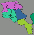
File:Armenia regions map.svg

Size of this PNG preview of this SVG file: 594 × 600 pixels. Other resolutions: 238 × 240 pixels | 476 × 480 pixels | 761 × 768 pixels | 1,015 × 1,024 pixels | 2,029 × 2,048 pixels | 750 × 757 pixels.
Original file (SVG file, nominally 750 × 757 pixels, file size: 1.24 MB)
File history
Click on a date/time to view the file as it appeared at that time.
| Date/Time | Thumbnail | Dimensions | User | Comment | |
|---|---|---|---|---|---|
| current | 22:33, 31 December 2012 |  | 750 × 757 (1.24 MB) | Travelpleb | Consolidated regions, Added capital |
| 10:09, 30 December 2012 |  | 750 × 757 (797 KB) | Travelpleb | Added neighboring countries and scale. Changed borders to reflect ''de facto'' situation. Borders from www.openstreetmap.org | |
| 03:31, 3 December 2012 |  | 750 × 757 (95 KB) | OgreBot | (BOT): Reverting to most recent version before archival | |
| 03:31, 3 December 2012 |  | 750 × 757 (85 KB) | OgreBot | (BOT): Uploading old version of file from wts.wikivoyage; originally uploaded on 2007-06-15 01:46:50 by (WT-shared) Peterfitzgerald | |
| 19:03, 25 November 2012 |  | 750 × 757 (95 KB) | MGA73bot2 | {{BotMoveToCommons|wts.oldwikivoyage|year={{subst:CURRENTYEAR}}|month={{subst:CURRENTMONTHNAME}}|day={{subst:CURRENTDAY}}}} == {{int:filedesc}} == {{Information |description=Map of Armenia's Regions. , Armenia * Map of: Armenia¤ |date=14 June 2007 |so... |
File usage
There are no pages that use this file.
Global file usage
The following other wikis use this file:
- Usage on nl.wikivoyage.org
- Usage on ru.wikivoyage.org