File:Antarctica (3), Adelaide Island, Wormald Ice Piedmont.JPG
Size of this preview: 800 × 531 pixels. Other resolutions: 320 × 213 pixels | 640 × 425 pixels | 1,024 × 680 pixels | 1,280 × 850 pixels | 1,716 × 1,140 pixels.
Original file (1,716 × 1,140 pixels, file size: 408 KB, MIME type: image/jpeg)
,_Adelaide_Island,_Wormald_Ice_Piedmont.JPG)
Summary
| Description |
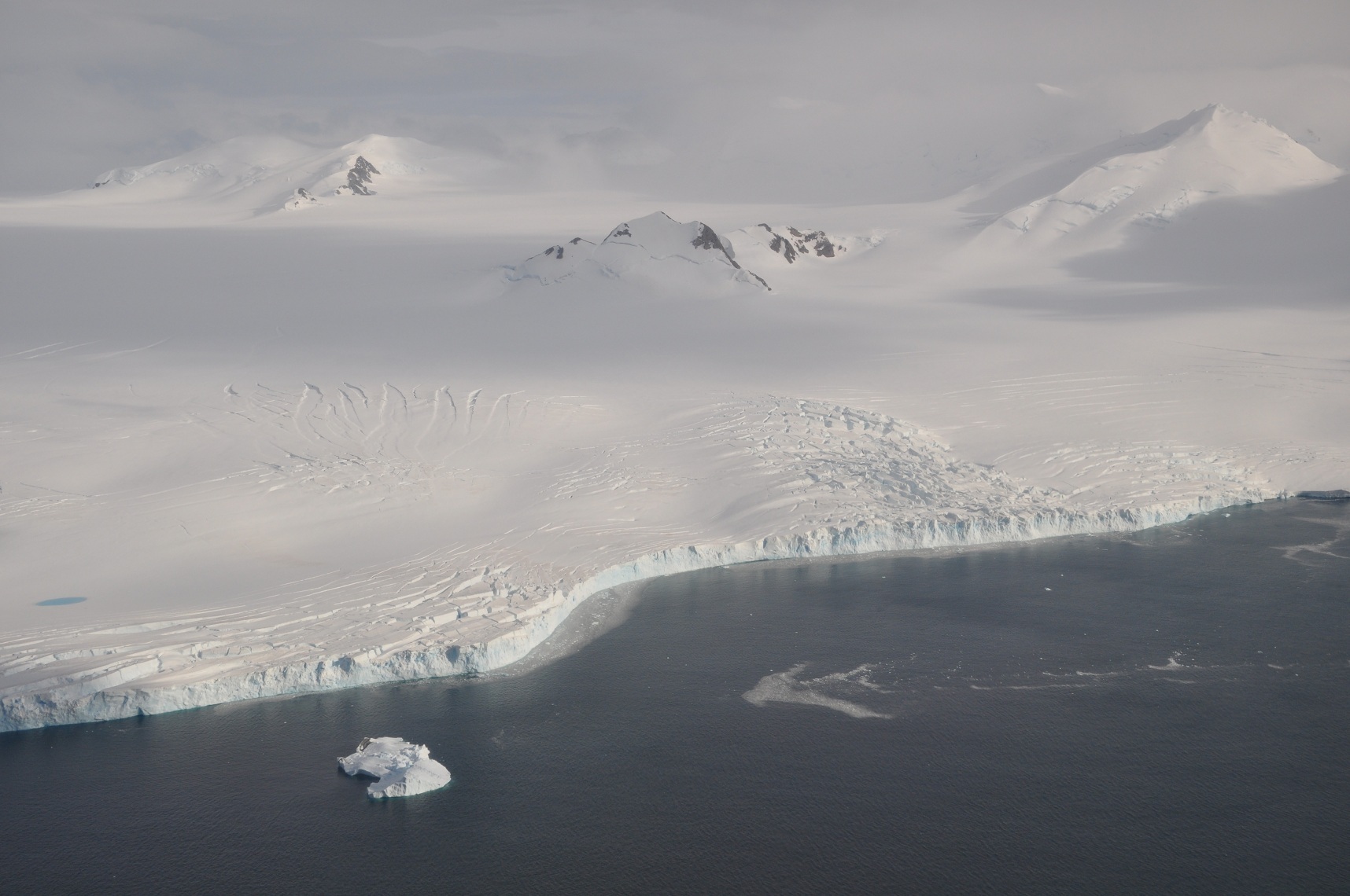
English: The Wormald Ice Piedmont covers large parts of the Wright Peninsula on eastern Adelaide Island, Antarctica, and terminates in high ice cliffs on Laubeuf Fjord. The nunatak in the centre of the picture has a height of 398 m. The mountains on the right form part of the Stokes Peaks and mark the northern edge of the ice piedmont. On the far left a melting pond can be seen on the ice. Viewing direction is toward the NNW. |
| Date | |
| Source | Own work |
| Author | Vincent van Zeijst |
•
| Camera location | | View this and other nearby images on: OpenStreetMap |
|---|
,_Adelaide_Island,_Wormald_Ice_Piedmont.JPG¶ms=-67.500686_N_-068.010864_E_globe:Earth_type:camera_heading:337.50&language=en)
Licensing
I, the copyright holder of this work, hereby publish it under the following license:
This file is licensed under the Creative Commons Attribution-Share Alike 3.0 Unported license.
- You are free:
- to share – to copy, distribute and transmit the work
- to remix – to adapt the work
- Under the following conditions:
- attribution – You must give appropriate credit, provide a link to the license, and indicate if changes were made. You may do so in any reasonable manner, but not in any way that suggests the licensor endorses you or your use.
- share alike – If you remix, transform, or build upon the material, you must distribute your contributions under the same or compatible license as the original.
File history
Click on a date/time to view the file as it appeared at that time.
| Date/Time | Thumbnail | Dimensions | User | Comment | |
|---|---|---|---|---|---|
| current | 21:48, 8 March 2011 | | 1,716 × 1,140 (408 KB) | Loranchet | {{Information |Description ={{en|1=The Wormald Ice Piedmont covers large parts of the Wright Peninsula on eastern Adelaide Island, Antarctica, and terminates in high ice cliffs on Laubeuf Fjord. The nunatak in the centre of the picture has a height of |
File usage
The following page uses this file:
Global file usage
The following other wikis use this file:
- Usage on azb.wikipedia.org
- Usage on ceb.wikipedia.org
- Usage on de.wikipedia.org
- Usage on de.wiktionary.org
- Usage on en.wikipedia.org
- Usage on fi.wikipedia.org
- Usage on he.wikipedia.org
- Usage on id.wikipedia.org
- Usage on li.wiktionary.org
- Usage on lv.wikipedia.org
- Usage on nn.wikipedia.org
- Usage on sv.wikipedia.org
- Usage on th.wiktionary.org
- Usage on www.wikidata.org
- Usage on zh.wikipedia.org
,_Adelaide_Island,_Wormald_Ice_Piedmont.JPG)