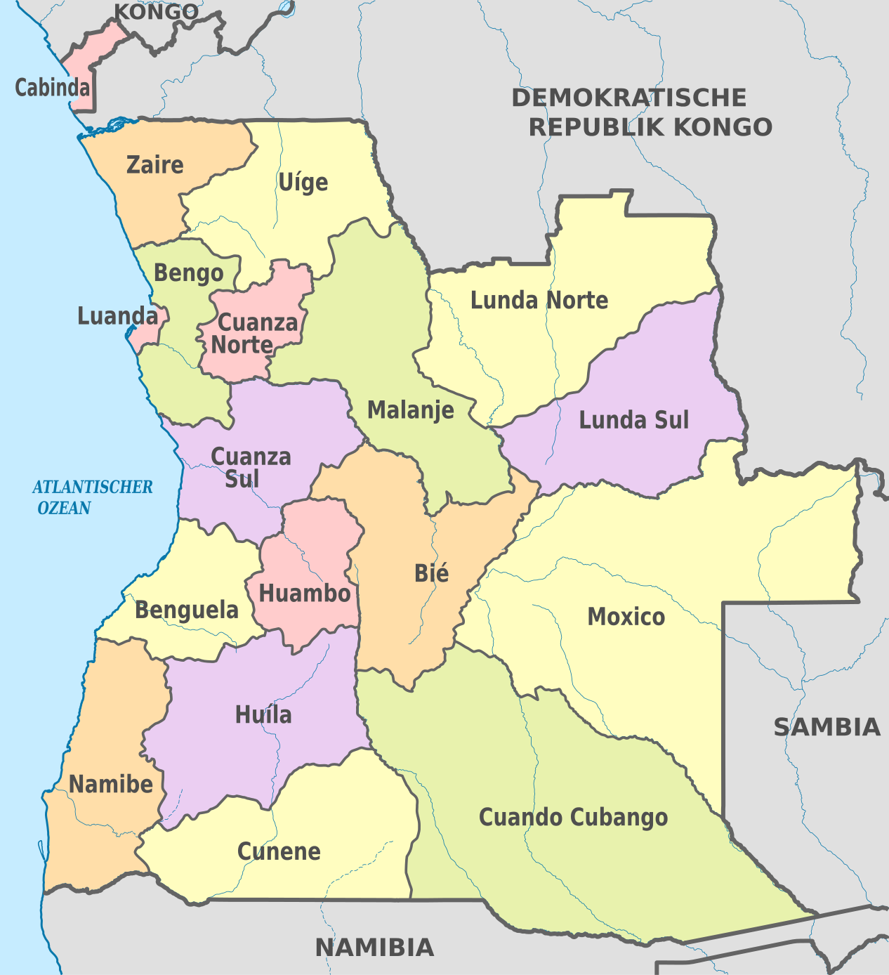
File:Angola, administrative divisions - de - colored.svg

Size of this PNG preview of this SVG file: 547 × 600 pixels. Other resolutions: 219 × 240 pixels | 438 × 480 pixels | 700 × 768 pixels | 934 × 1,024 pixels | 1,868 × 2,048 pixels | 1,266 × 1,388 pixels.
Original file (SVG file, nominally 1,266 × 1,388 pixels, file size: 612 KB)
Summary


.svg)


_(Paris_zoom).svg)
.svg)
,_administrative_divisions_-_de_-_colored_(multizoom).svg)
_-_colored.svg)
.svg)
,_administrative_divisions_-_Nmbrs_(multizoom).svg)
,_administrative_divisions_-_de_-_colored.svg)
_-_de_-_colored.svg)

.svg)

.svg)

Licensing
I, the copyright holder of this work, hereby publish it under the following licenses:

|
Permission is granted to copy, distribute and/or modify this document under the terms of the GNU Free Documentation License, Version 1.2 or any later version published by the Free Software Foundation; with no Invariant Sections, no Front-Cover Texts, and no Back-Cover Texts. A copy of the license is included in the section entitled GNU Free Documentation License. |
This file is licensed under the Creative Commons Attribution-Share Alike 3.0 Unported, 2.5 Generic, 2.0 Generic and 1.0 Generic license.
- You are free:
- to share – to copy, distribute and transmit the work
- to remix – to adapt the work
- Under the following conditions:
- attribution – You must give appropriate credit, provide a link to the license, and indicate if changes were made. You may do so in any reasonable manner, but not in any way that suggests the licensor endorses you or your use.
- share alike – If you remix, transform, or build upon the material, you must distribute your contributions under the same or compatible license as the original.
You may select the license of your choice.

|
I'd greatly appreciate, that you attribute this media file to Wikimedia Commons, if used outside Wikipedia or Commons. For use in publications such as books, newspapers, blogs, websites, please insert here the following line:
|
File history
Click on a date/time to view the file as it appeared at that time.
| Date/Time | Thumbnail | Dimensions | User | Comment | |
|---|---|---|---|---|---|
| current | 08:42, 29 October 2012 | | 1,266 × 1,388 (612 KB) | TUBS | == {{int:filedesc}} == {{Information |Description={{de|Karte der politischen Gliederung von XY (siehe Dateiname)}} {{en|Map of administrative divisions of XY (see filename)}} |Source={{own}}{{Adobe Illustrator}}{{Commonist}}{{AttribSVG|Angola_-_Bengo.... |
File usage
The following page uses this file:
Global file usage
The following other wikis use this file:
- Usage on af.wikipedia.org
- Usage on als.wikipedia.org
- Usage on ast.wikipedia.org
- Usage on ca.wikipedia.org
- Província de Cabinda
- Bengo
- Província de Benguela
- Bié
- Cuando Cubango
- Kwanza-Nord
- Kwanza-Sud
- Cunene (Angola)
- Província de Huambo
- Huíla
- Província de Luanda
- Lunda-Nord
- Lunda-Sud
- Província de Malanje
- Província de Moxico
- Província de Namibe
- Província de Uíge
- Província del Zaire
- Organització territorial d'Angola
- Províncies d'Angola
- Plantilla:Províncies d'Angola
- Usage on de.wikipedia.org
- Usage on de.wikivoyage.org
- Usage on es.wikipedia.org
- Usage on frr.wikipedia.org
- Usage on hu.wiktionary.org
- Usage on it.wikipedia.org
- Usage on mt.wikipedia.org
- Usage on sco.wikipedia.org
- Usage on tr.wikipedia.org
- Usage on zh.wikipedia.org