File:Airbus A320, AirAsia, Samarinda International Airport.jpg
Size of this preview: 800 × 254 pixels. Other resolutions: 320 × 101 pixels | 1,006 × 319 pixels.
Original file (1,006 × 319 pixels, file size: 56 KB, MIME type: image/jpeg)
Summary
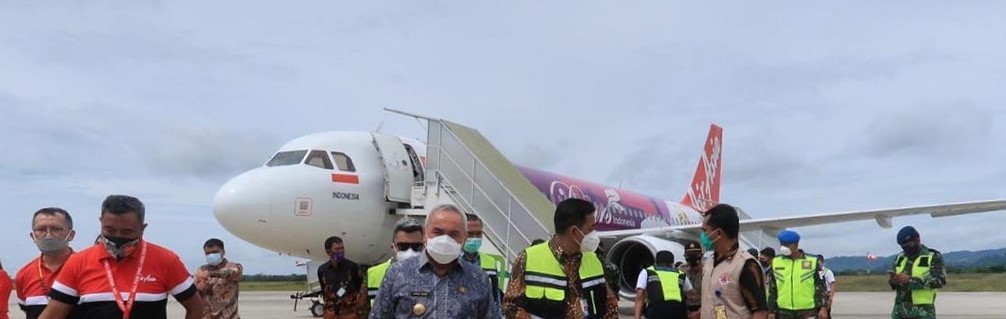
| Description |
English: The first Malaysian airline (Airbus A320-216, PK-AZN) to land at Samarinda International Airport |
| Date | |
| Source | https://kaltimprov.go.id/berita/2021-bandara-apt-pranoto-mulai-dikembangkan |
| Author | Government of East Borneo |
| Camera location | | View this and other nearby images on: OpenStreetMap |
|---|
Licensing
| This file is in the public domain in Indonesia, because it is published and distributed by the Government of Republic of Indonesia, according to Article 43 of Law 28 of 2014 on copyrights.
There shall be no infringement of Copyright for:
|
 |
File history
Click on a date/time to view the file as it appeared at that time.
| Date/Time | Thumbnail | Dimensions | User | Comment | |
|---|---|---|---|---|---|
| current | 16:34, 28 June 2021 | 1,006 × 319 (56 KB) | Jellylovers | Uploaded a work by Government of East Borneo from https://kaltimprov.go.id/berita/2021-bandara-apt-pranoto-mulai-dikembangkan with UploadWizard |
File usage
The following 3 pages use this file:
Global file usage
The following other wikis use this file:
- Usage on en.wikipedia.org
- Usage on id.wikipedia.org