File:Peru - Moquegua Department (locator map).svg

Size of this PNG preview of this SVG file: 492 × 600 pixels. Other resolutions: 197 × 240 pixels | 394 × 480 pixels | 630 × 768 pixels | 840 × 1,024 pixels | 1,679 × 2,048 pixels | 820 × 1,000 pixels.
Original file (SVG file, nominally 820 × 1,000 pixels, file size: 1.03 MB)
.svg)
| Description |
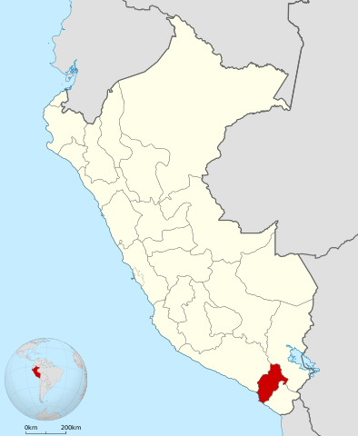
English: Locator map of Moquegua Department in Peru.
Español: Mapa de ubicación del Departamento de Moquegua en el Perú. |
| Date | (UTC) |
| Source | |
| Author |
|
.svg)
I, the copyright holder of this work, hereby publish it under the following license:
This file is licensed under the Creative Commons Attribution-Share Alike 3.0 Unported license.
- You are free:
- to share – to copy, distribute and transmit the work
- to remix – to adapt the work
- Under the following conditions:
- attribution – You must give appropriate credit, provide a link to the license, and indicate if changes were made. You may do so in any reasonable manner, but not in any way that suggests the licensor endorses you or your use.
- share alike – If you remix, transform, or build upon the material, you must distribute your contributions under the same or compatible license as the original.
Original upload log
This image is a derivative work of the following images:
- File:Peru_-_(Template).svg licensed with Cc-by-sa-3.0
- 2009-07-21T07:54:54Z Huhsunqu 820x1000 (1674312 Bytes) detail map
- 2009-07-15T06:39:44Z Huhsunqu 820x1000 (1396540 Bytes) ANCHOS
- 2009-07-06T05:07:34Z Huhsunqu 820x1000 (1398457 Bytes) {{Information |Description={{en|1=Blank political map of Perú}} {{es|1=Mapa plantilla de las regiones y departamentos del Perú.}} |Source=trabajo propio (own work) |Author=[[User:Huhsunqu|Huhsunqu]] |Date=2009-07-05 |Permis
Uploaded with derivativeFX
File history
Click on a date/time to view the file as it appeared at that time.
| Date/Time | Thumbnail | Dimensions | User | Comment | |
|---|---|---|---|---|---|
| current | 19:31, 1 May 2018 | | 820 × 1,000 (1.03 MB) | Janitoalevic | Fixed. |
| 20:57, 4 February 2010 |  | 820 × 1,000 (1.45 MB) | Huhsunqu | {{Information |Description={{en|1=Locator map of en:Moquegua Department in Peru.}} {{es|1=Mapa de ubicación del es:Departamento de Moquegua en el Perú.}} |Source=*File:Peru_-_(Template).svg |Date=2010-02-04 20:45 (UTC) |Author=*[[:File |
.svg)
File usage
The following page uses this file:
Global file usage
The following other wikis use this file:
- Usage on an.wikipedia.org
- Usage on ar.wikipedia.org
- Usage on ast.wikipedia.org
- Usage on ay.wikipedia.org
- Usage on be.wikipedia.org
- Usage on bg.wikipedia.org
- Usage on ca.wikipedia.org
- Usage on da.wikipedia.org
- Usage on de.wikipedia.org
- Usage on en.wikipedia.org
- Department of Moquegua
- Ilo Province
- Regions of Peru
- Omate
- El Algarrobal District
- Ilo District
- Pacocha District
- Lloque District
- La Capilla District
- Ichuña District
- Coalaque District
- Chojata District
- Matalaque District
- Omate District
- Puquina District
- Quinistaquillas District
- Ubinas District
- Yunga District
- Carumas District
- Cuchumbaya District
- Moquegua District
- Samegua District
- San Cristóbal District, Mariscal Nieto
- Torata District
- Template:Moquegua-geo-stub
- El Algarrobal
- Lake Jucumarini
- Lake Vizcacha
- User:Ramatteo/Sandbox
- Jichu Qullu (Peru)
- Qillqata (Arequipa-Moquegua)
- Pachakutiq (Arequipa-Moquegua)
- Tacune
- Pirhuane (mountain)
- Pucasaya (Moquegua)
- Pacoorcco (Moquegua)
View more global usage of this file.
.svg)
.svg)