File:Morocco (west africa orthographic projection).svg

Size of this PNG preview of this SVG file: 550 × 550 pixels. Other resolutions: 240 × 240 pixels | 480 × 480 pixels | 768 × 768 pixels | 1,024 × 1,024 pixels | 2,048 × 2,048 pixels.
Original file (SVG file, nominally 550 × 550 pixels, file size: 373 KB)
.svg)
| Description |
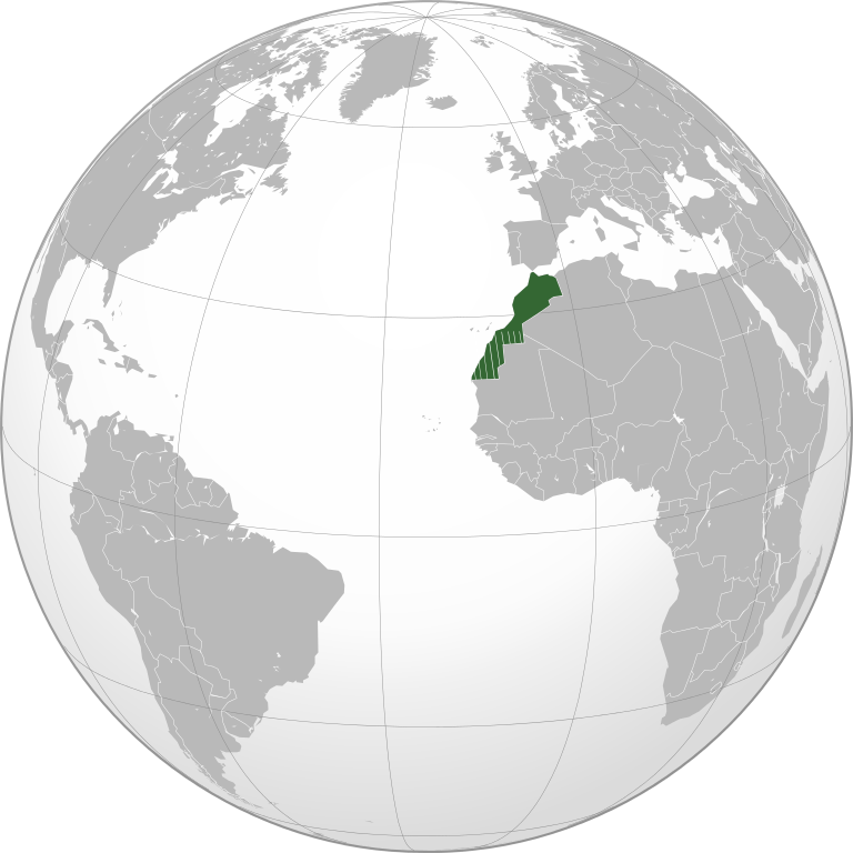
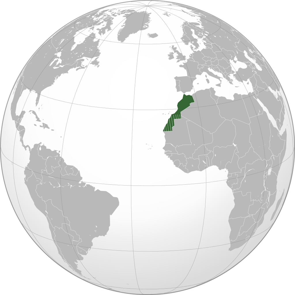
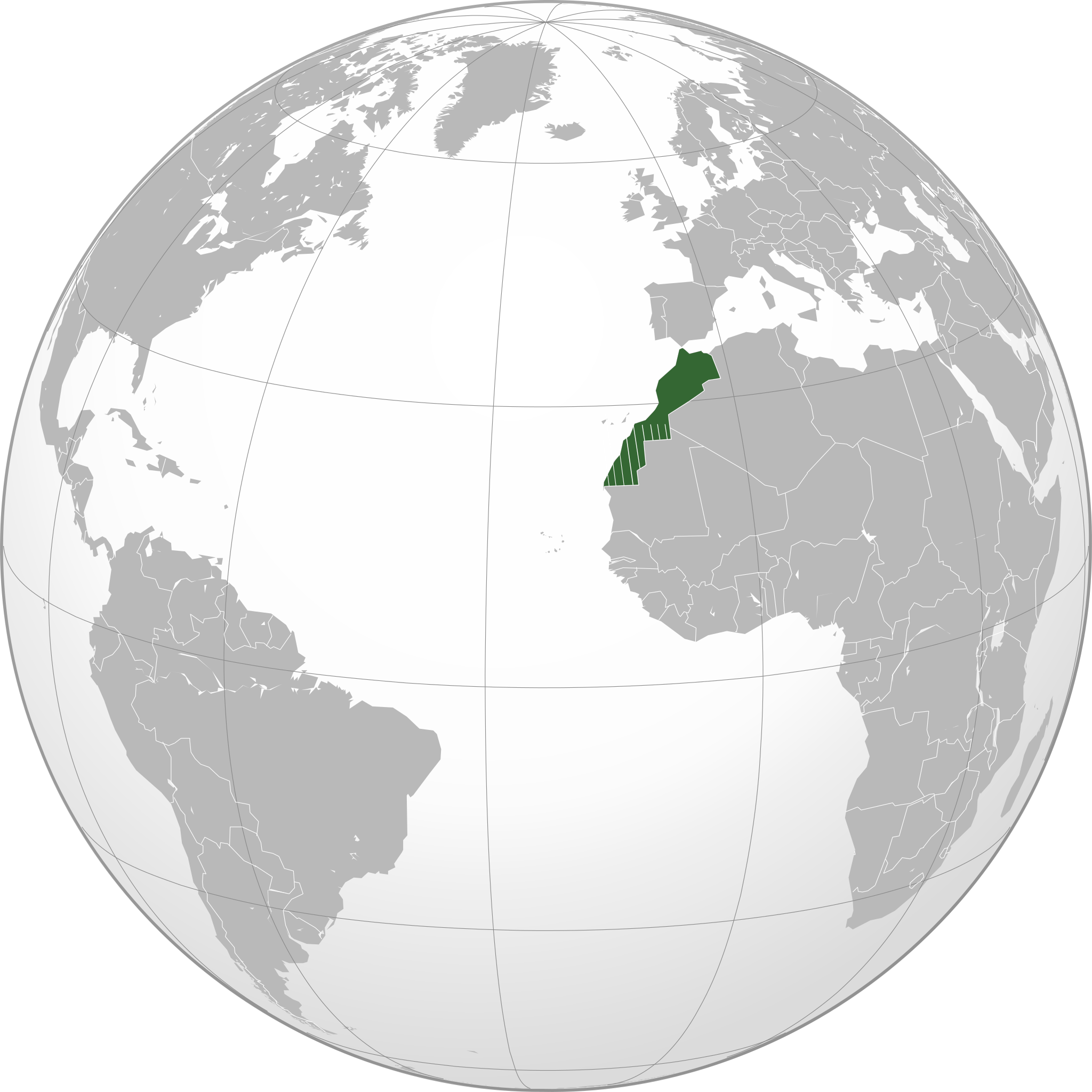
English: Locator of Morocco and its disputed territory Western Sahara shown as striped (West Africa orthographic projection). United Nations recognize Morocco as an administrative power of the territory. Report of the Secretary-General of the United Nations |
| Date | |
| Source | Own work |
| Author | Flad |
The map has been created with the Generic Mapping Tools: https://www.generic-mapping-tools.org/ using one or more of these public-domain datasets for the relief:
|

|
Permission is granted to copy, distribute and/or modify this document under the terms of the GNU Free Documentation License, Version 1.2 or any later version published by the Free Software Foundation; with no Invariant Sections, no Front-Cover Texts, and no Back-Cover Texts. A copy of the license is included in the section entitled GNU Free Documentation License. |
File history
Click on a date/time to view the file as it appeared at that time.
| Date/Time | Thumbnail | Dimensions | User | Comment | |
|---|---|---|---|---|---|
| current | 16:01, 20 November 2010 | | 550 × 550 (373 KB) | Flad | {{Information |Description={{en|1=Locator of Morocco and its disputed territory Western Sahara shown as striped (West Africa orthographic projection). United Nations recognize Morocco as an administrative power of the territory. [http://www.un.org/documen |
| 15:36, 20 November 2010 |  | 550 × 550 (364 KB) | Flad | {{Information |Description={{en|1=Locator of Morocco and its disputed territory Western Sahara shown as striped (West Africa orthographic projection). United Nations recognize Morocco as an administrative power of the territory. [http://www.un.org/documen |
File usage
The following 4 pages use this file:
Global file usage
The following other wikis use this file:
- Usage on ar.wikipedia.org
- Usage on arz.wikipedia.org
- Usage on zgh.wikipedia.org
.svg)